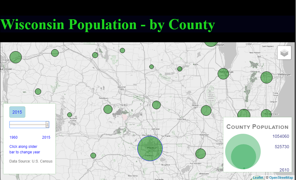
Interactive Web Map Showing Wisconsin Population
An interactive Leaflet map showing Wisconsin Population. This web map has population data from 1960 through 2015. Moving the slider will change the population year and dynamically update the circle sizes based on the current years population. Hovering over a circle will display a popup indicating that counties population for the currently selected population year. JavaScript, Leaflet and jQuery was used to create this web map. Data was converted to geoJSON format. The basemap is from OpenStreetMap.
Left Click on the Map to Display the actual Leaflet map