Mobile Gas Leak Detection Using Vehicle Methane Detection
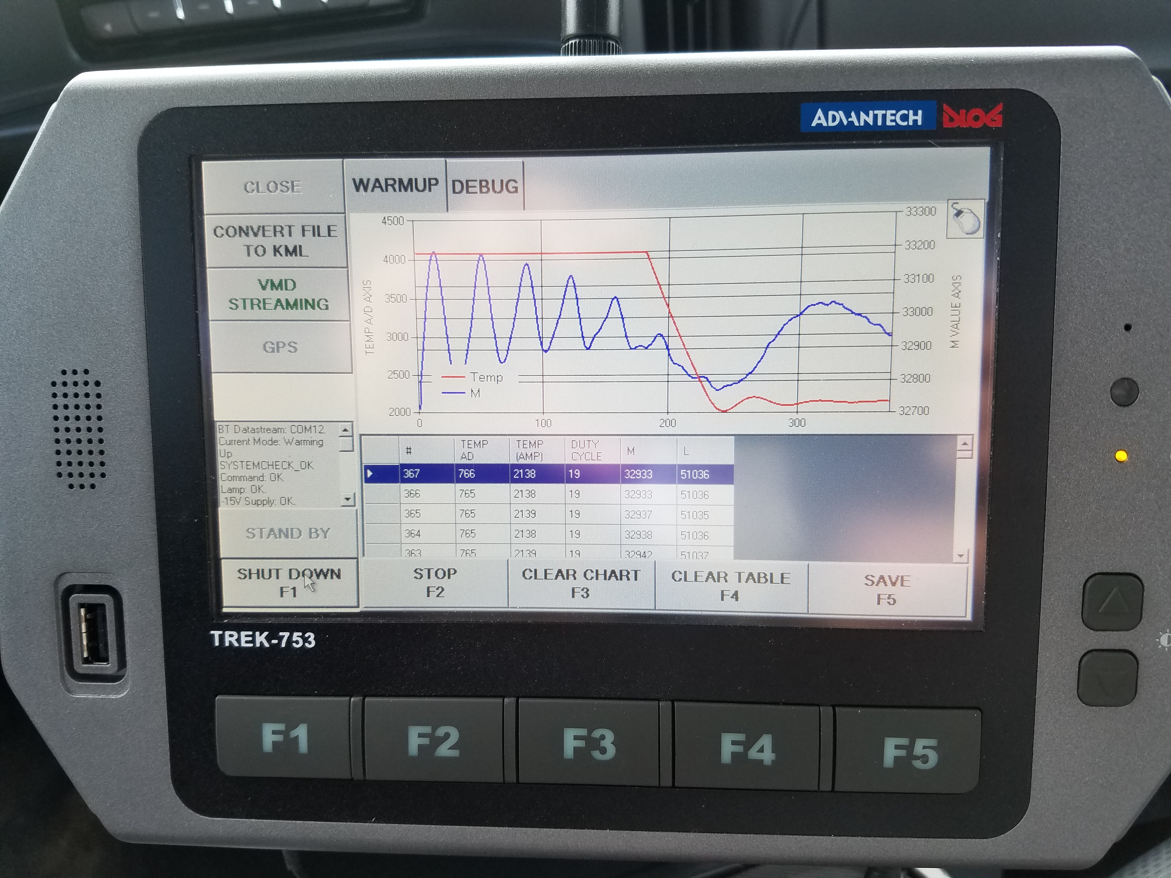
This was a fun project that is currently in production. Data collection is 3 Times Faster than the old method. I developed a number of applications, including a Python add-in on a Panasonic ToughPad running ArcMap to interface with a mobile Gas Leak Detection system and provide near real-time results of what roads and gas main pipe have been surveyed. A Bluetooth connection captures GPS coordinates and PPM readings that can be displayed in ArcMap. Final results are logged so they can be appended to a point feature class in an Oracle database for analysis and long term storage.
2017 GeoConX Presentation
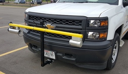
Here is the Vehicle Methane Detection console that is connected to the lite bar.
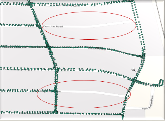
GPS points are displayed on the map using the ArcMap and the ToughPad in the truck. It is easy to see if any roads have been missed, saving the operator the time of having to head back into the field to complete the survey.